
Leesburg ZIP Code Coverage
Four official USPS labels are associated with Leesburg, Virginia: 20175, 20176, 20177, and 20178. The official county map and GIS material visibly show 20175 and 20176 in the Leesburg area. The other two have official USPS Leesburg labels, but the inspected static sources do not establish their precise residential or special-use details. A postal label is useful evidence for delivery research, but it is not a census, parcel, precinct, or Town-limit boundary.
| ZIP | Areas covered | Post office context | Directory note |
|---|---|---|---|
| 20175 | Standard Leesburg street-delivery area shown in county, GIS, and USPS material | Main Branch address uses this ZIP | Verify each address with USPS; no complete neighborhood boundary list was located |
| 20176 | Standard Leesburg street-delivery area shown on county and GIS sources | Downtown Branch address uses this ZIP | Exact carrier-route boundary was not located |
| 20177 | Official USPS Leesburg label | Facility or delivery detail not established in inspected sources | Do not describe it as a residential street area without address-level USPS confirmation |
| 20178 | Official USPS Leesburg label and county mailing context | Clerk mailing address uses P.O. Box 550 | Treat as mailing context unless USPS confirms a specific address |
The Town lists the Leesburg Post Office Main Branch at 25 Catoctin Circle SE with 20175 and the Downtown Branch at 15 E Market Street with 20176. Those branch addresses confirm postal examples, not the full geography of either ZIP.
USPS Postal Checks for Leesburg
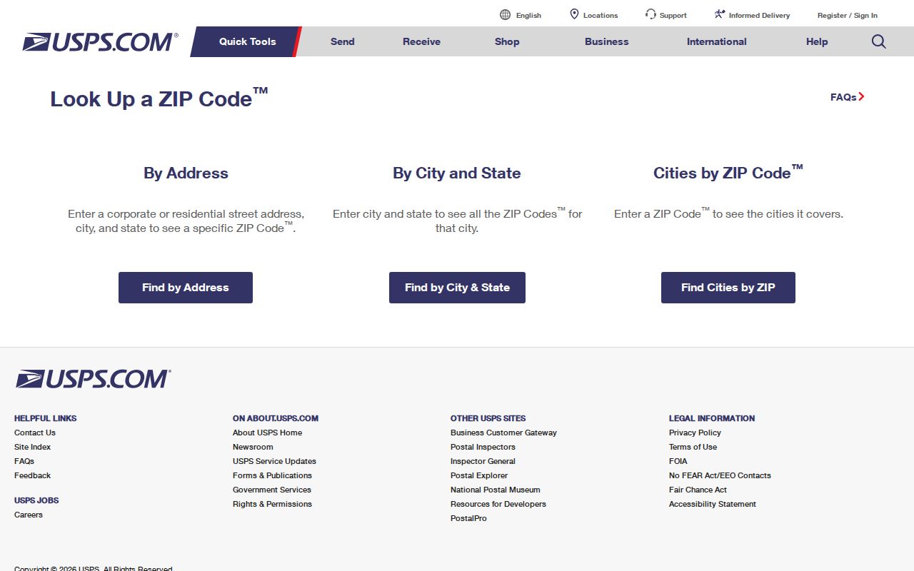
The official USPS lookup is the postal starting point. Its By Address mode requires Street Address plus City and State, with company, apartment or suite, and ZIP as optional fields. By City and State requires a city and state and returns ZIPs. Cities by ZIP takes a ZIP and returns recognized city information. USPS also warns that a recognized city name and standardized formatting matter, and that a result does not confirm a person or company at an address.
| USPS mode | Input to use | What it answers |
|---|---|---|
| By Address | Street Address, City, and State | Standardized delivery address and ZIP for a particular location |
| By City and State | City and State | ZIPs associated with the postal city entry |
| Cities by ZIP | ZIP | Recognized city labeling for that postal code |
The USPS postal lookup shows these three modes and the address fields used to resolve a Leesburg delivery address.
Use the resulting ZIP as a postal field, then compare it with the parcel and jurisdiction held by the relevant public-record custodian.
Leesburg Postal Labels
USPS label material provides a compact cross-check for the four local codes. The inspected L007 reference associates 20175 and 20178 with LEESBURG VA and groups 20176 through 20177 with LEESBURG VA. This supports the city label, not a claim about a street-delivery area, an individual, or a municipal boundary. For 20177 and 20178, an address-level USPS result is the safer next step because the static material did not classify their facilities or residential status.
The USPS label reference is the source for the official Leesburg ZIP-label associations used here.
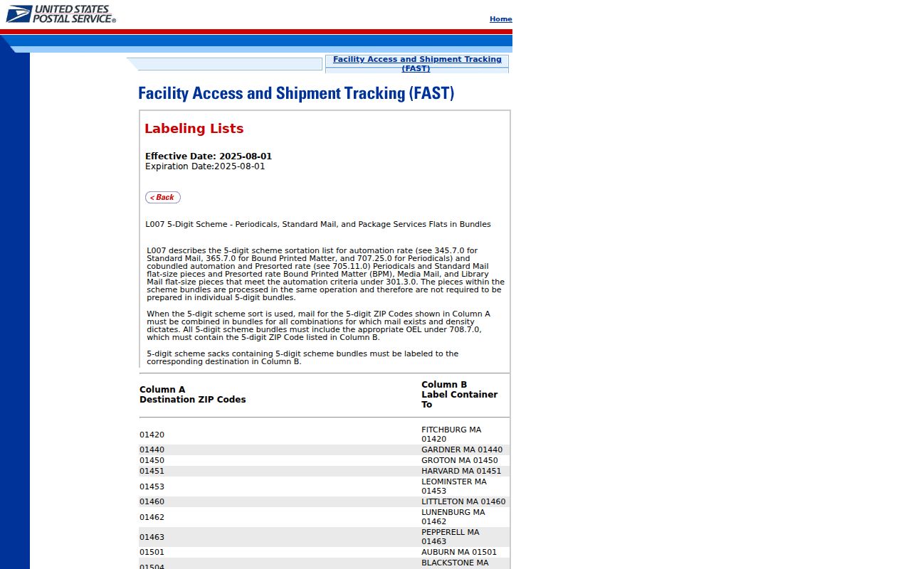
The label list is a useful postal reference, while a delivery question still requires the USPS lookup for the actual address.
Search a Leesburg ZIP Code in Property Records
Loudoun Real Property Search accepts ZIP Code as an optional field alongside Parcel ID, Land Use Code, Street #, Street, selectors for street direction, type, and suffix, Tax Map Number, and Deactivated Accounts. It can narrow address-keyed property research within a postal area. Basic street searching omits the suffix; Advanced Search adds ranges such as year built, number of stories, and tax-map range. The live result screen was unavailable during the research inspection, so current display fields and redactions should be verified on the portal.
| Property-search field | ZIP research use |
|---|---|
| ZIP Code | Optional postal filter for parcel-account research |
| Street # and Street | Pairs a ZIP with a normalized physical address |
| Parcel ID | Checks a known property directly |
| Tax Map Number | Links an address result to map research |
| Deactivated Accounts | Includes or excludes inactive accounts in the result set |
WebLogis then resolves an address or PIN on the map, rather than offering a documented ZIP search field. It can supply parcel geometry, plats, and adjoining-parcel context. For a street-wide address chain after a ZIP has narrowed the area, use the Leesburg street directory route instead of treating the ZIP alone as the property boundary.
Find a Leesburg ZIP Code Record Trail
A Leesburg postal search should narrow a record question, not create a ZIP-wide list of people. The assessor uses ZIP as an optional property filter. GIS uses address and PIN for location work. The voter status service has a different purpose: it requires identity details and authorization, while regulated voter-list products use locality, district, election, and date filters rather than ZIP. No per-ZIP registration or population table was located in the inspected official sources.
- Run the known address through USPS and retain the standardized address, recognized city name, ZIP, and retrieval date.
- Use the ZIP, street number, and street in Loudoun Real Property Search when the question concerns a parcel account or tax-map clue.
- Open the matching address or PIN in WebLogis to compare parcel geometry and recorded map context.
- Use the Clerk's deed index, a Town permit route, or an historical repository only when its record type fits the address and time period.
- For voter information, use locality and district through the authorized state route, not a ZIP as a substitute for either field.
That sequence keeps postal, parcel, and election geography distinct. It also avoids treating a delivery label as proof of Town residence.
Leesburg ZIP Codes Are Not Town Lines
County GIS metadata describes ZIP boundaries as address-assignment and general postal areas. An unincorporated Loudoun address can use Leesburg as its postal city, and a Town office can use a ZIP that does not mark the Town boundary. Census ZCTAs, municipal limits, parcel geometry, precincts, and ZIPs are separate geographic systems. A missing property hit in a ZIP search calls for USPS address resolution and GIS, not a conclusion that the location does not exist.
- ZIP and ZIP+4
- A ZIP identifies a postal delivery area. ZIP+4 adds a more precise delivery segment but remains a postal, not legal, boundary.
- PO-box ZIP
- A ZIP used for post-office box delivery. The research did not establish 20177 or 20178 as exclusively PO-box ZIPs.
- Unique ZIP
- A ZIP associated with one organization or facility. No such classification was confirmed for the less-detailed Leesburg labels.
- Carrier route
- A postal delivery sequence used to move mail. It is not a Town or parcel boundary.
Separate Leesburg ZIP and Parcel Fields
Keep three address identities together but separate: situs address, mailing address, and legal description. The situs identifies where a parcel or permitted activity is located. The mailing field identifies where an owner, office, or agency receives correspondence. The legal description identifies land through a lot, block, subdivision, metes-and-bounds, easement, or deed language. A Loudoun tax-book sample distinguishes “OWNER AND MAILING ADDRESS” from “NO SITUS ADDRESS,” which is a useful warning against merging the fields.
Loudoun Mapping and Geographic Information is the local GIS and addressing contact, at 1 Harrison Street SE, Leesburg, VA 20175, telephone 703-771-5778. The inspected sources did not locate a dated townwide E911 readdressing project, a complete quadrant-numbering guide, or an annexation-driven renumbering schedule. When an historic number fails to map, request an addressing-history or E911 record from the County or Town with the old and current street text, lot or PIN, ZIP, jurisdiction, plat, and source date.
Note: Postal maintenance, parcel updates, court locality, and historic street names can change on different schedules, so record each source's own lookup date.
Old Leesburg Streets Outlast a ZIP
Postal filtering is recent compared with Leesburg's street history. Carolina Road became King Street and US 15, while Potomac Ridge Road became Market Street and VA 7. Loudoun Street's former east-west role and later Fayette Street name are additional historic keys. When a past address does not match a current ZIP or geocode cleanly, use the historic road text beside the current street, then compare the deed legal description, lot or plat, and current PIN.
The 1759 town plan and the 1858 road-survey history make those aliases useful for family, property, and neighborhood history. They do not establish a modern delivery address. A source date and a parcel or map check keep the record trail clear.