
Trace a Leesburg Street by Address
To search a Leesburg street, begin with the address as it is written on current mail, then preserve any older spelling beside it. An address can lead to a parcel account, a map shape, a recorded instrument, or a dated historical mention. Those are different kinds of evidence. The strongest street-by-street result records the address, PIN, source, date, and role shown by the source. It does not turn a parcel owner or an old directory entry into an occupancy claim.
- Normalize the street, unit information, city, state, and ZIP with USPS. Retain an earlier road name if a deed, map, or newspaper uses one.
- Use the Loudoun Real Property Search with the street number and street. Record the PIN, tax-map reference, account status, legal description, and lookup date.
- Open the same address in WebLogis. Check parcel edges, plat information, map location, and any separate common-area, parking, or garage parcel.
- Follow the current deed reference through the Clerk's index. Compare lot, legal description, road, and adjoining-owner clues before moving backward through a grantor-grantee chain.
- Use dated Balch collections, Census material, newspapers, or a verified reverse directory only for the historical role and date they document. A modern street-level question can then continue through the Leesburg city directories when historical volumes are the better source.
That order keeps the search focused on address-keyed records. It also makes gaps visible: a road can include common areas, undeveloped parcels, inactive accounts, and address variants that are not apparent in a name search.
Leesburg Street Directory Property Fields
The county's assessment portal is the first current parcel layer for an address search. Basic search offers Property Address, Parcel ID Number, Tax Map Number, Advanced Searches, and Combined Search modes. The address form accepts a street number and street, while the basic street entry should omit the suffix. Asterisks can be used for wildcard searching. The portal also describes a 12-character parcel ID, optional land-use and ZIP fields, sort controls, pagination, and an option for deactivated accounts.
| Visible field | How it helps an address search |
|---|---|
| Parcel ID | Targets a known parcel and supports a direct cross-check with GIS. |
| Street # and Street | Finds an address or a street segment; omit the suffix in the basic street field. |
| ZIP Code | Narrows a postal area, but does not establish a Town boundary. |
| Tax Map Number | Connects property research to map and historic-reference work. |
| Advanced Search | Adds ranges such as year built, stories, and tax-map range. |
| Deactivated Accounts | Lets a search include or exclude inactive accounts. |
The Real Property Search may display ownership or deed information, mailing and situs information, sales, values, and house characteristics. Its live result screen was unavailable during the research inspection, so the current public owner display and any redactions should be checked on the actual result. No public owner-name search was confirmed.
The linked assessor search screen shows the address, parcel, tax-map, ZIP, and advanced-search paths used for this query.
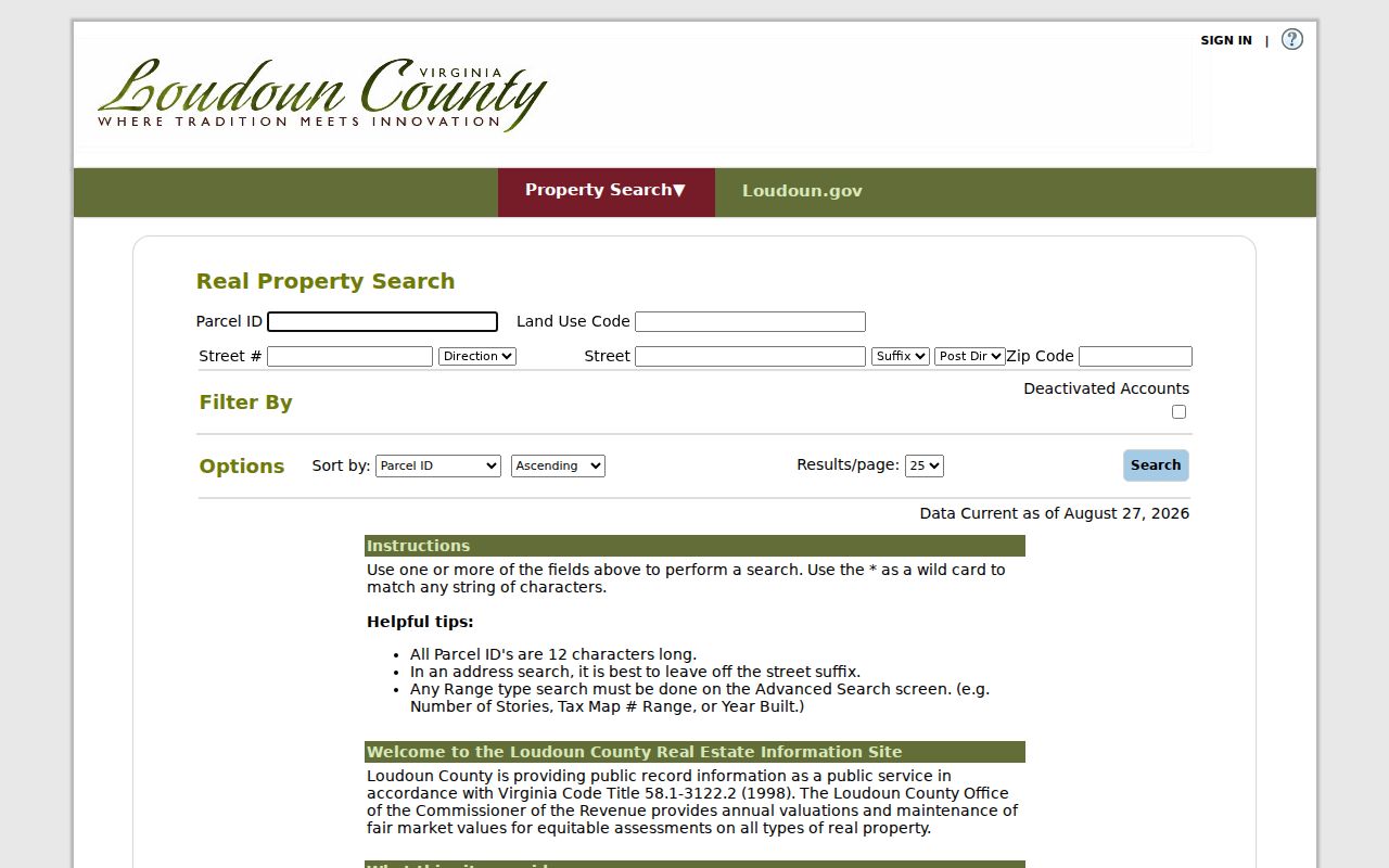
Its field layout is useful for finding a parcel record, not for declaring who occupies an address.
Map a Leesburg Street in WebLogis
WebLogis supplies the geometry missing from an assessment row. Its public help documents Find Address with autocomplete, a map-click method, PIN searching, Search Assessments by property address or tax map, and parcel tools for a selected result. A 12-digit PIN is reduced to the first nine digits for tile behavior. Use the map to distinguish a street parcel from a road, outlot, common area, or separately assessed garage before reading the row as part of a street sequence.
The public WebLogis search help also describes Show Parcel, Show Parcel and Adjoiners, distance searching, results controls, print, and parcel-and-plat-file information. A distance result can cover up to one mile, or 5,280 feet. Labels may be suppressed when more than 50 parcels are returned. The owner-address-list function is marked internal only, so it is not a public mailing-list route.
The WebLogis help screen documents the public address, PIN, adjoining-parcel, and distance tools that support a street-by-street review.
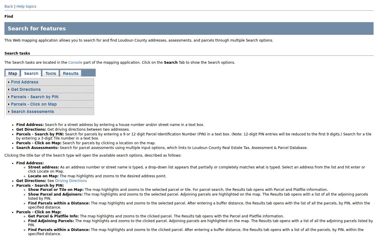
Map geometry can establish shared boundaries and parcel context, but it cannot establish a personal relationship between nearby owners.
Leesburg Records Searchable by Street
A full Leesburg street directory trail uses records that share an address but answer different questions. The assessor deals with an account and assessment. GIS deals with the parcel's location and boundaries. The Clerk preserves instruments and legal descriptions. Permit systems track applications, status, and inspections. Historical sources may attach a person or organization to an address at a known date. Each row below identifies the most direct route and the limitation that should travel with it.
| Address-keyed source | What it can show | Leesburg access route | Important limit |
|---|---|---|---|
| Assessment / parcel | PIN, legal description, ZIP, values, sales, and account fields | Real Property Search | Public owner-name lookup was not confirmed |
| WebLogis / plat | Parcel shape, adjoiners, roads, map and plat context | Public GIS viewer | Owner address lists are internal only |
| Deed index | Grantor, grantee, legal description, book/page, and plat clues | Clerk historic indexes and public terminals | An index hit does not prove occupancy |
| Permit record | Address, application or project, inspections, and status | Town eTRAKiT or County inquiry | Town and County systems differ |
| USPS address lookup | Delivery-standard address and postal ZIP | USPS lookup | Postal area is not a municipal boundary |
| Historical collection | Dated address, household, place, or building context | Thomas Balch Library collections | Exact local reverse-directory runs need verification |
For a whole road, repeat a normalized street search with a number range, ZIP, and pagination when useful. Preserve each PIN and account status. Then use the GIS map to explain apparent gaps before tracing selected parcels in deeds. This is more reliable than treating every name that shares a road text string as connected to that street.
- Parcel
- A mapped unit of land with an assessment identity, commonly called a PIN in Loudoun records.
- Situs address
- The place where a parcel or permitted activity is located, distinct from an address used for mail.
- Plat
- A recorded map that can show subdivision lots, boundaries, easements, and road relationships.
- Criss-cross directory
- A historical address-first directory format that may connect a street entry to a dated occupant or organization.
Leesburg Street Names Need History
Historic address work needs older road text beside the current label. Town history identifies Carolina Road as King Street and US 15, and Potomac Ridge Road as Market Street and VA 7. Loudoun Street also served as the main east-west street before the later Fayette Street name, with an 1858 terminus survey adding another date-specific clue. These are search keys for deeds, newspapers, maps, and early town material, not a reason to rewrite a current mailing address.
Leesburg's 1759 plan and the county's unusually intact historic records help explain why an address trail may shift among town lots, roads, legal descriptions, and present parcel IDs. The Clerk reports historic material beginning in 1757, while the exact first and last printed Leesburg directory runs remain a research gap. When a number will not geocode, request an addressing-history or E911 record through the Town or County and provide the old and current street text, parcel or lot, ZIP, jurisdiction, and source date.
Note: A historical street match needs a date, a road-name variant, and a supporting parcel or deed reference before it can be treated as the same place.
Separate Leesburg Address Roles
One property can carry several valid address fields. The situs address identifies where a parcel or permitted activity is located. A mailing address identifies where correspondence goes. A legal description identifies land through lot, block, subdivision, metes-and-bounds, easement, or deed language. USPS resolves postal formatting and ZIP, while the assessor accepts ZIP as a search filter and GIS resolves an address or PIN. None of those fields should be silently substituted for another.
A Loudoun tax-book example distinguishes “OWNER AND MAILING ADDRESS” from “NO SITUS ADDRESS.” That small distinction matters when a street record is incomplete. Store postal city, ZIP, parcel, jurisdiction, and record date separately. If only a postal-city match is available, treat it as a delivery clue, not proof that the property lies within Town limits.
Leesburg Street Records Change by Era
The address trail changes with the record system. Early town lots, deed books, wills, tax records, and court material can describe a place before a current street number existed. Later newspapers, town minutes, telephone material, maps, and photographs may add a dated address layer. Current assessment and GIS tools add parcel identity and geometry. Loudoun's Clerk says its historic collection avoided destruction by fire, war, and environment, but each index still has its own limits and coverage.
Keep a dated chain rather than blending results from different eras. A record found through an 1886 map, a nineteenth-century deed index, or a current GIS result has a distinct purpose. That discipline is especially useful when a historic road name and a modern street label point to the same corridor but not necessarily the same numbered address.
Leesburg Street Deeds Reach to 1757
The Loudoun Clerk records deeds, deeds of trust, assignments, certificates of satisfaction, judgments, subdivision plats, and related instruments. For a selected Leesburg street parcel, start with the current deed reference, then read the current grantee and the prior grantor alongside the same lot, acreage, road, legal description, and adjoining-owner clues. A grantor is the party transferring an interest; a grantee is the party receiving it. Following the prior owner as grantor creates a backward chain, but it remains a property history rather than a list of residents.
The Loudoun historic deed indexes provide six alphabetical PDF ranges from 1757 through 1903. The plat index is not all-inclusive because many plats are embedded in deed books from 1757 through the middle of the twentieth century. Public terminals at the Courts Complex and Clerk's office are the coverage baseline when a remote image is unavailable. The Clerk asks for a specific reference rather than conducting an open-ended search; its mailing address uses P.O. Box 550, Leesburg, VA 20178.
The historic deed-index page shows the PDF ranges used to move a street parcel into earlier records.
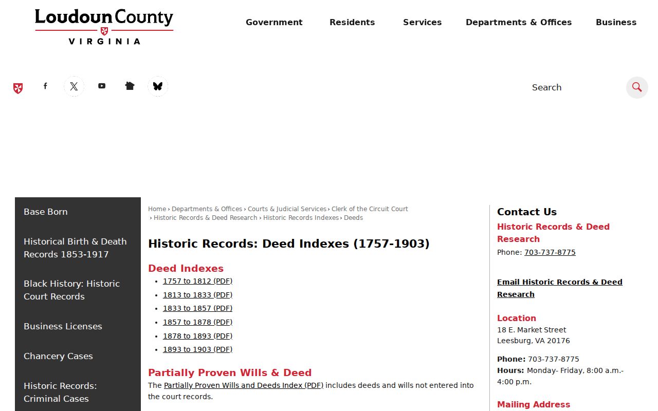
The image points to an index path. Confirm the legal description and instrument before attaching a deed entry to a specific Leesburg address.
Leesburg Street Permits and Voter Limits
Permit material can supply a dated address trail without proving that a person lived there. The Town uses eTRAKiT for municipal applications, inspection status, public-record access, and fee payment. Loudoun County Building and Development uses a permit inquiry form that asks for a property address, permit number or date, summary, requester contact, submission method, and attachments. The County states an inquiry response should arrive within two business days. The exact public eTRAKiT field set and result pagination were not captured, so they should not be promised.
Virginia's voter-status service is also not a street-browsing tool. Its public status form requires first and last name, date of birth, last four Social Security digits, locality, and an affirmation of own or authorized use. The separate voter-list request form uses declared client/use categories and locality, district, election, and date filters. It does not use ZIP as a general street filter. Protected information remains excluded under Virginia Code §24.2-444.
Limits of a Leesburg Street Directory
A public address result can show a parcel account, a recorded owner relationship, a mailing field, a permit event, or a dated historical mention. It cannot reliably show every household member, delivery recipient, utility customer, private association member, or non-title occupant. WebLogis does not make a bulk owner-address list public, and a deed or postal match does not show current residence. Driver-address information has separate legal protections, while protected voter addresses and Virginia Address Confidentiality Program information must not be exposed.
When the public record stops, ask the relevant custodian for an existing record with an address, date range, and record type. The Thomas Balch Library collections are a better route for historical household and place research than forcing a current parcel record to answer a past question.